TNA to NOA Node
The National Observatory of Athens (NOA) conducts ionospheric sounding measurements providing data and products to research community.
Athens Digisonde-Portable-Sounder-4D (DPS4D):
- URSI code: AT138
- Location: Penteli (Athens) Greece (GEO 38.0° N, 23.5° E)
- Control and Data Platforms: LINUX and Windows 8.1, respectively
- Transmitter Cards that support the signal processing of short-pulse waveform and long-pulse waveform
- Frequency scan: 0.5 – 30 MHz
- Data archiving: SAO, SAOXML, RSF/SBF, SKY, DVL, TLT
- http://195.251.202.49/
- Build-in Software:
- ARTIST 5.0 – ionogram scaling
- DFT2SKY – Skymap calculation
- DDAV – Calculation of drift velocity
- DRGMaker – Calculation of directogram
- TILT – Calculation of ionospheric tilt
- Online image tools – production of images
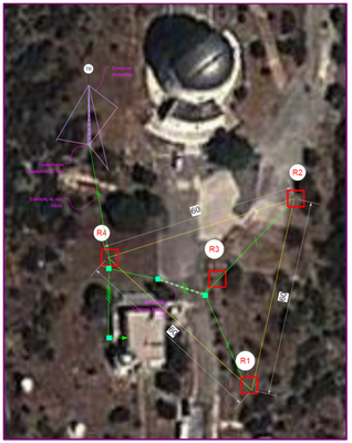
Geometry of the Athens DPS4D installation
Athens DPS4D experiments:
- Standard mode
- Vertical soundings every 5 min (carried out routinely): scanning ionogram; F-region drifts.
- Special modes
- Vertical soundings: fixed‐frequency ionogram; E-region drifts.
- Bi-static oblique soundings jointly with one or more Digisonde systems (Digisonde-to-Digisonde operation).
- Programmable selection of frequencies or frequency bands.
- Flexible scheduling of sampling cadence.
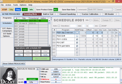
DCART (Digisonde Commanding and Acquisition Remote Terminal) application allows the selection of the sounding parameters
Digisonde related data and products:
- Ionospheric echoes parameters: Amplitude, phase, direction of arrival, virtual height, Doppler frequency & spread, ordinary & extraordinary wave polarization identification.
- Ionospheric electron density profiles; ionospheric characteristics including foF2, foF1, foE, foEs, MUF(3000)F2, hmF2, hmF1, hmE and the IRI parameters B0, B1 and more (49 in total). Data archiving: SAO, SAOXML.
- Ionosphere visualization products: Ionograms; Skymaps; Drift velocity plots; Directograms.

- Near-by GNSS (Global Navigation Satellite System) data: PENT Equipment TOPCON Net-G3, sampled with 30 or 1sec, with data, in tps, RINEX or RTK NOA1 sampled at 30sec, in daily RINEX.
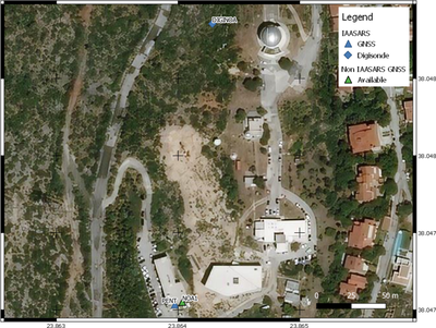
Athens Digisonde distance from PENT and NOA1 at 200m at an azimuth of -170°.
Other close stations include:
| GNSS | Distance (km) | Azimuth (o) |
| METO | 9.5 | -80 |
| DION | 6.7 | 62 |
| DYNG | ||
| RAFI | 13 | 105 |
| ATHI | 19.4 | -131 |
| KERT | 29.1 | 160 |
Ionospheric predictions:
The European Digital Upper Atmosphere Server (DIAS) e-infrastrure (http://dias.space.noa.gr) operated by NOA delivers nowcasts, as well as short- and long-term predictions of ionospheric characteristics over Europe based on the implementation of ionospheric prediction models. The DIAS database contains data and model results from 2005 until today.
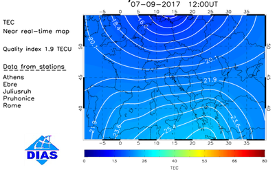
An example of DIAS TEC maps
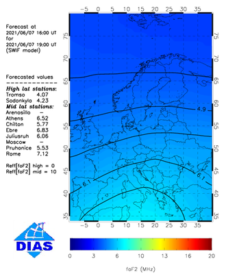
An example of DIAS forecasting maps
Detection and prediction of TIDs:
The TechTIDE-EC H2020 warning system e-infrastructure (http://www.tech-tide.eu/) provides detection and prediction of Travelling Ionospheric Disturbances (TIDs) over Europe and Africa, based on several complementary methodologies. The TechTIDE database contains data and model results from 2017 onwards.
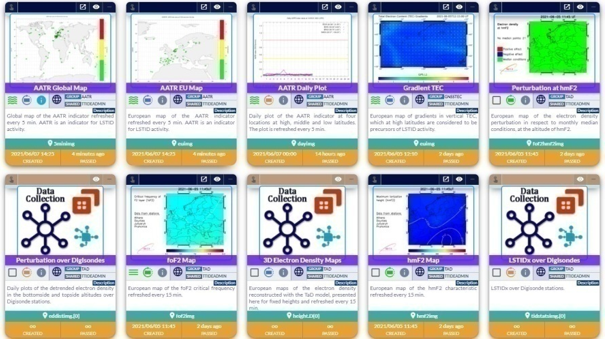
Areas of access
NOA node is open to experiment proposals in the following fields:
Ionospheric modeling for nowcasting and forecasting purposes. Indicatively:
- Modeling formulation of ionospheric storm effects at middle latitudes driven by solar wind input;
- Data - driven ionospheric specification models, using different training data sets and/or deep-learning techniques ;
- Ensemble modeling for ionospheric predictions using heliospheric forecasting models;
- Reconstruction of electron density profile by ingesting ground and space-based observations.
Validation of ionospheric specification models compatible with international practices, such as the recommendations by Community Coordinated Modeling Center (CCMC) of NASA and Space Weather Service Network of ESA.
Ionospheric data control: development of higher-level data-products based on ionospheric autoscaled data filtering algorithms.
Ionospheric irregularities and travelling ionospheric disturbances (TIDs). Research and application activities on:
- Identification and propagation patterns for TIDs
- Bottomside and topside ionosphere interactions
- Identification of post-seismic effects in the ionosphere
Digisonde experiments
- Vertical Soundings
- Joint experiments/special campaigns with bistatic HF sounders’ operations.
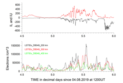
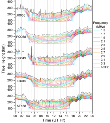
TNA to NOA Node info (downloadable pdf file)
Contact persons: Dr Ioanna Tsagouri (tsagouri@noa.gr), Dr Anna Belehaki (belehaki@noa.gr)
