GNSS receiver network
GPS, GLONASS, BeiDou and Galileo are all Global Navigation Satellite Systems (GNSS) that provide positioning, navigation and timing (PNT) services worldwide. GPS, the most well-known system, was originally developed by the USA for military purposes. GLONASS is the Russian counterpart, and more recently the European Galileo and the Chinese BeiDou systems have also become available.
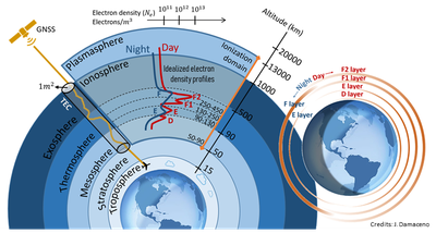
GNSS satellites fly about 20,000 km above the Earth’s surface. The transmitter on board of each GNSS satellite emits signals in (at least) two different L-band (1-2 GHz) frequencies. These signals pass through the plasmasphere, the ionosphere, the thermosphere and the lower atmosphere before reaching a GNSS receiver on the ground. This modifies the intensity and phase of the travelling signals. The influence of the ionosphere and the troposphere is particularly important. At the receiver these modifications have to be accounted for to provide reliable PNT services.
But what is unwanted for the PNT services, is exactly what scientists exploit to study the atmosphere. GNSS signals can be used to monitor and investigate the ionosphere. The change of refractive index in the ionosphere introduces a delay of the signal and a change of its phase. The ionospheric refractive index is proportional to the number of free electrons that are present in the portion of the ionosphere probed by each GNSS signal, and due to the dependence of the refractive index on the frequency of the GNSS signal, the delay recorded by the receiver provides an estimation of the so-called Total Electron Content (TEC). TEC is defined as the total number of free electrons inside a (fictive) cylinder of 1m2 section from the GNSS satellite to the receiver on the ground. This is visualized in Figure 1.
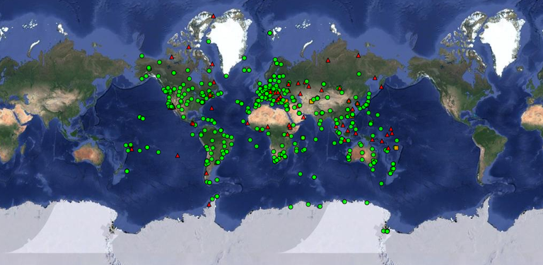
Ionospheric studies can rely on large networks of GNSS receivers available for PNT services and scientific use. The International GNSS Service network is show in Figure 2 as an example.

Figure 1. Total Electron Content (TEC) measurement using the propagation of GNSS signals (Courtesy J. Damaceno).

Figure 2. Receiver locations of the International GNSS Service network. Credits: Tiles © Esri — Esri, DeLorme, NAVTEQ
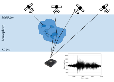
When the free electrons that are present in the ionosphere are unevenly distributed, regions of enhanced or depleted electron density may form: ionospheric irregularities. When the GNSS signals pass through such irregularities, rapid variations are superimposed on the GNSS signals and the received signals scintillate, as shown in Figure 3. These effects, too, are a problem from the point of view of PNT services, but useful for scientific investigations: monitoring the appearance of scintillation provides us with information about small scale irregularities forming in the ionosphere.

Figure 3. Ionospheric irregularities and a received signal with scintillation (bottom-right). Courtesy J. Damaceno.
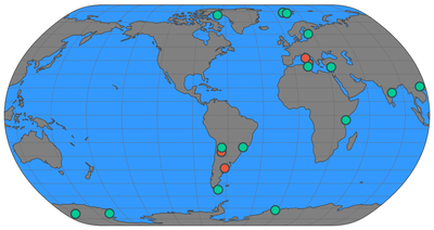
Monitoring and investigation of ionospheric scintillation is usually done with specially configured GNSS receivers. The networks of this type of receivers are not as dense as the “common” GNSS receivers, but several institutions operate TEC and scintillation receivers specifically intended for scientific use (see the example given in Figure 4).

Figure 4. Network of the TEC and scintillation receivers (green dots) managed by INGV, partner in the PITHIA-NRF project (http://www.eswua.ingv.it/index.php/network/network-status).
